
Ready for starting the ultimate journey of Best Camping Places in USA! From peaceful beaches retreats to wonderful mountainsides. It’s time to load your stuff into the car and head out on the open road if you’re excited to enjoy the great outdoors this summer and winter. Beautiful places exist in our country and are just waiting for you to find them. Imagine having individual glamping accommodations in the middle of New York City or relaxing island vacations in Florida.
Imagine yourself sleeping under the stars on the beautiful beaches of California or discovering hidden gems in one of our stunning national parks. Whether you prefer luxury or simplicity, these locations have a little bit of everybody. You might even get to see foxes, horses, and wild buffalo while you’re around.
1) TWO HARBORS CALIFORNIA, CATALINA ISLAND
California Two Harbors is an hour’s boat journey away from the California coast, and Catalina Island, which is perched on a hill overlooking the Pacific, exudes the feel of a summer camp. It also has spectacular vistas and the chance to witness wild buffaloes.
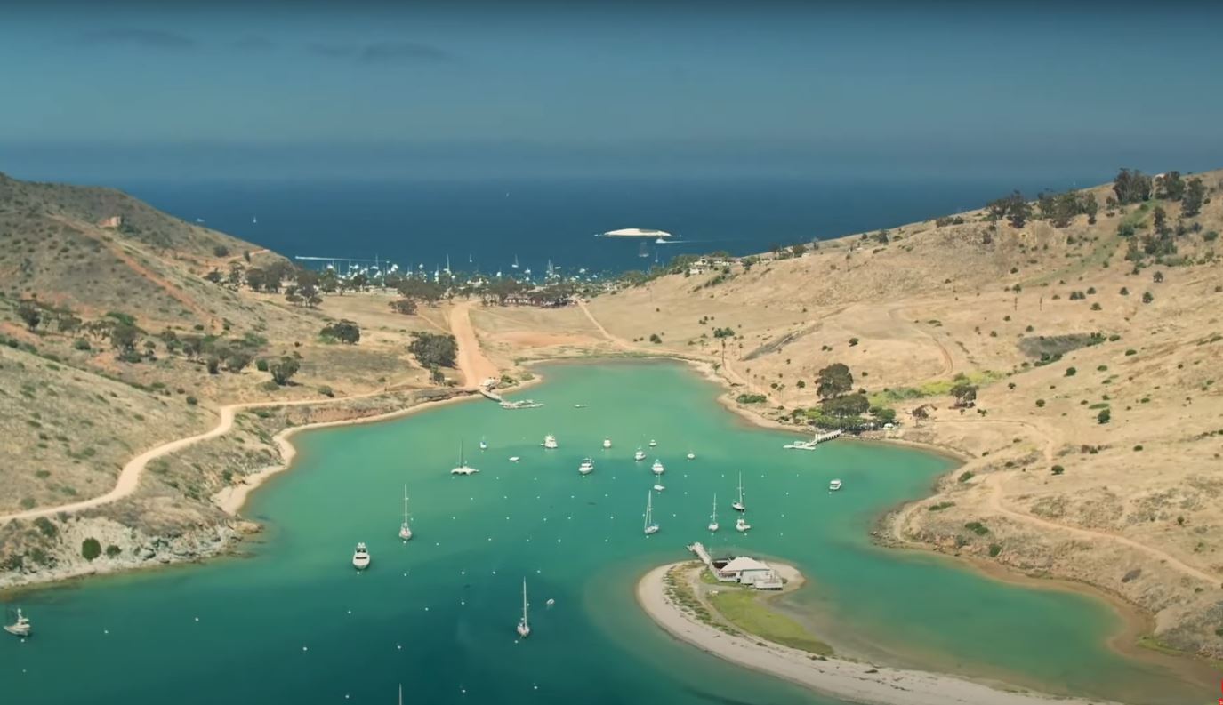
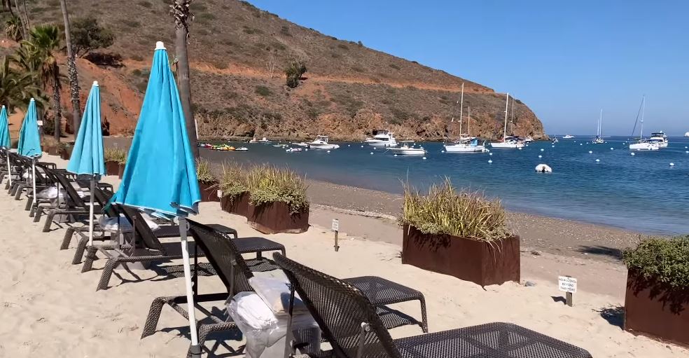 The campground at two Harbors provides conventional tent camping as well as cabins with access to showers. restrooms, drinking water, and picnic tables Fire pits and barbecues. Even better, you may order your items from the two harbors general shop and have them delivered right to your campsite.
Location and Map:
The island is located about 29 mi (47 km) south-southwest of Long Beach, California.

| Coordinates | 33°23′N 118°25′W |
| Area | 74.98 sq mi (194.2 km2) |
| Highest elevation | 2,097 ft (639.2 m) |
| Highest point | Mount Orizaba |
| Largest settlement | Avalon (pop. 3,460) |
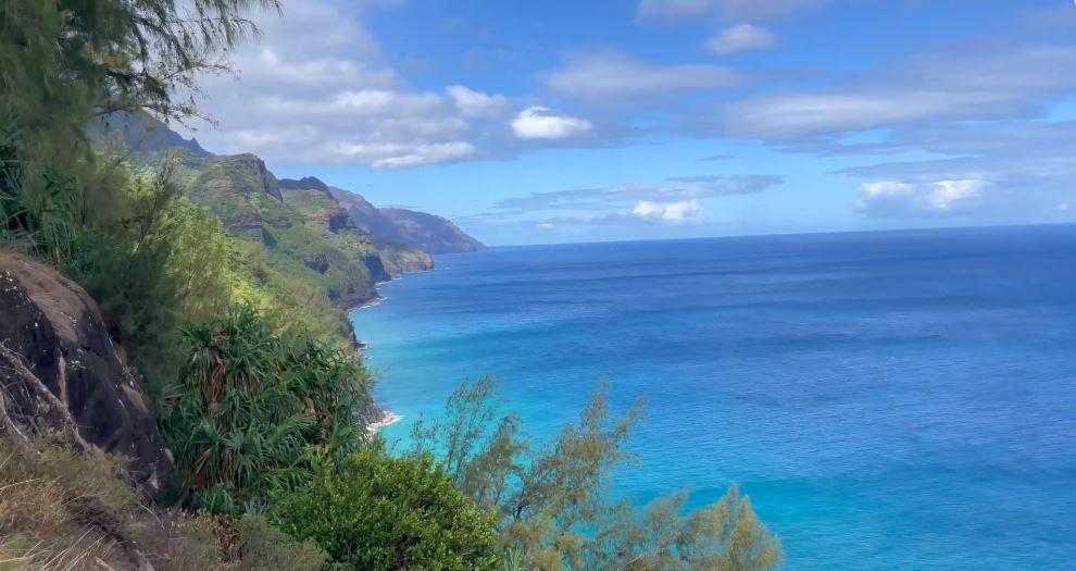
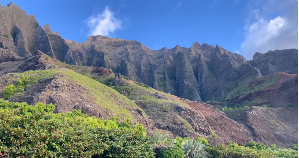
2) HAWAII KALALAU BEACH, KAUAI
Kapaa Kalalau beach in Hawaii, The campsite at Kalalau Beach is one of many incredible campsites on the island of Kauai, but it is situated at the conclusion of a lovely 11-mile hike in Nepali Coast State Park. You’ll be rewarded with a waterfall and some beach time before setting up camp on cliffs that provide breathtaking views of the island’s famed coastline and the current number-one Catalina Island.
Location and Map:
Located Nāpali Coast State Wilderness Park which is part of the Hawaii State Parks system.

| Coordinates | 33°23′N 118°25′W |
| Area | 74.98 sq mi (194.2 km2) |
| Highest elevation | 2,097 ft (639.2 m) |
| Highest point | Mount Orizaba |
| Largest settlement | Avalon (pop. 3,460) |
3) ARIZONA NORTH RIM, GRAND CANYON
The North Rim refers to the northern edge or boundary of a geographical feature or area. The Grand Canyon holds a prominent position on many individuals’ list of desired experiences, commonly referred to as a “bucket list.” However, it is crucial not to underestimate the aesthetic value of this remarkable natural wonder.
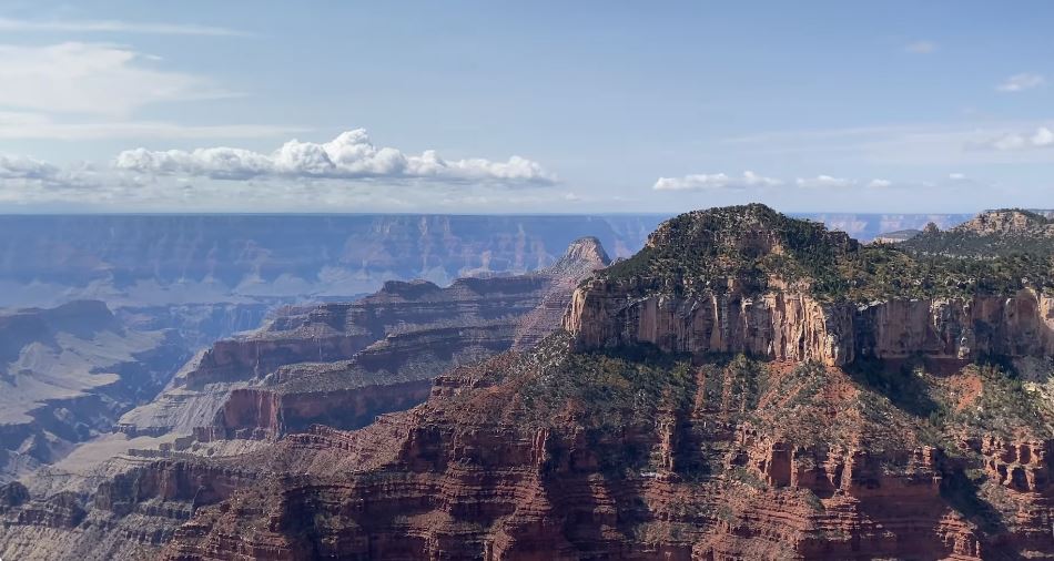
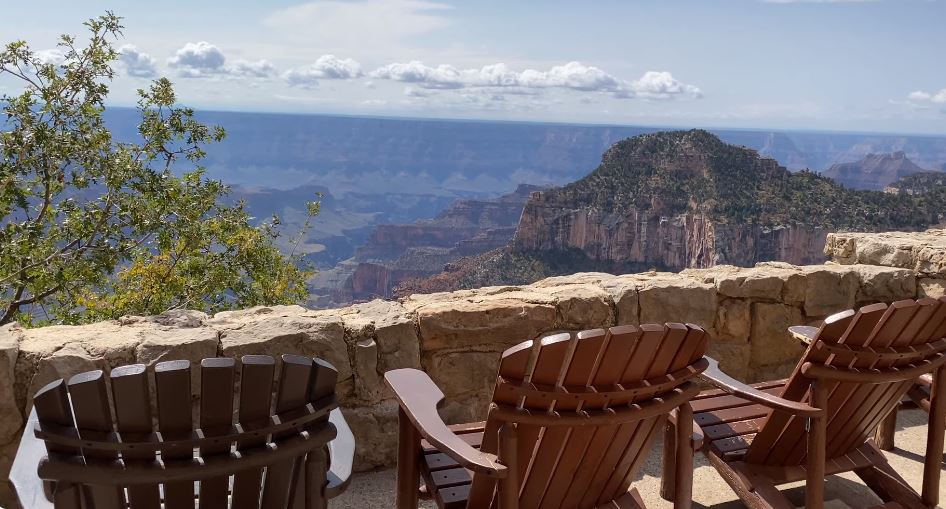 For those who choose to engage in camping activities within the confines of the national park, it is advisable to consider the North Rim as a preferable option due to its relatively lower levels of congestion compared to the more extensively developed South Rim. It is worth noting that campsites are allocated on a first-come, first-served basis this year, necessitating an early arrival for those seeking to immerse themselves in the tranquilly and inherent magnificence of these non-rapid campgrounds.
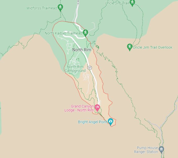
Location and Map:
Grand Canyon located in the northwest corner of Arizona.
| Floor elevation | Approx. 2,600 feet (800 m) |
| Length | 277 miles (446 km) |
| Width | 4 to 18 miles (6.4 to 29.0 km) |
| Age | 5–6 million years |
| Rivers | Colorado River |
4) SD SAGE CREEK PRIMITIVE CAMPGROUND,
BADLANDS NATIONAL PARK
The Dakota Sage Creek Primitive Campground is a designated camping area that offers a rustic and minimalistic camping experience. There is no need for concern if one were to awaken to the auditory presence of bison meandering in close proximity to their tent, as this is a customary phenomenon at the campground situated within Badlands National Park.


Vault toilets, also known as pit toilets or pit latrines, are a type of sanitation facility commonly seen in outdoor recreational areas The rural site has limited amenities, including picnic benches and a horse corral. However, visitors will have the opportunity to observe the prairie landscape transition into a golden hue after sunset, witness prairie dogs emerge from their burrows, and listen to the nocturnal howling of wolves.
Location and Map:
Badlands national park located in southwestern South Dakota.

| Coordinates | 43°45′N 102°30′W |
| Area | 242,756 acres (982.40 km2) |
| Established | January 25, 1939 as a National Monument |
| Nearest city | Rapid City, South Dakota |
| Visitation | 1,006,809 (in 2022) |
| Website | Badlands National Park |
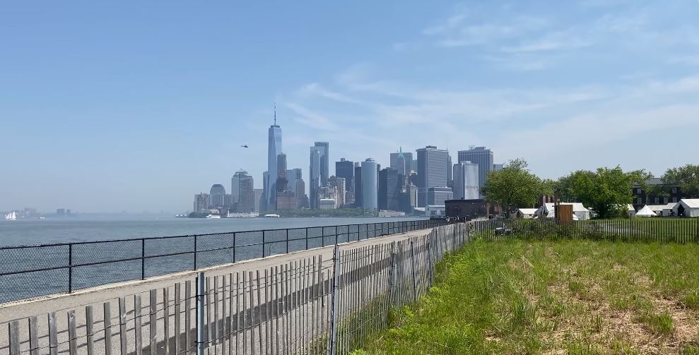
5) NEW YORK COLLECTIVE GOVERNORS ISLAND, GOVERNORS ISLAND
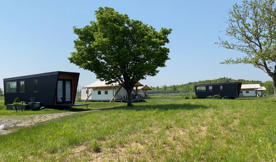
Governors Island New York Collective Governors Island is glamping more your style? This posh establishment on Governors Island has your number. A private water taxi will whisk you away to accommodations like the shared Three Peaks Lodge or a private tent with an ensuite bathroom and air conditioning. And don’t come here expecting just hot dogs; the on-site chef prepares a multi-course farm-to-table dinner every night. Plus, there are those unmatched views of the city.
Location and Map:
It is located approximately 800 yards (730 m) south within the New York City borough of Manhattan.

| Coordinates | 40°41′29″N 74°0′58″W |
| Area | 172 acres (70 ha) |
| Established | June 28, 1980 |
| Highest point | Outlook Hill |
| Visitation | 800,000 (2018) |
| Website | Governors Island |
6) CALIFORNIA TREEBONES RESORT, BIG SUR
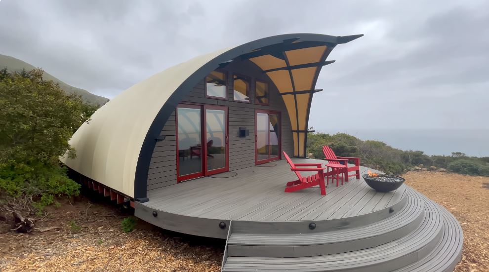
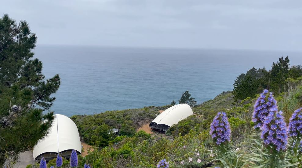
Tree Bones Inn It’s the human bird nest at the tree bones resort in Big Sur that earns them the top spot on this list. Climb the private ladder to the human-sized nest made of eucalyptus branches, and you’ll find a 180-degree view of the coast. The nest comes with a full-size futon mattress, but you’ll need to bring necessities like pillows, sleeping bags and a torch in at the top.
Location and Map:
It is located in California’s Central Coast region, 26 miles (42 km) south of Carmel in the Big Sur River Valley.

| Coordinates | 36.299216°N 121.873402°W |
| Area | 74.98 sq mi (194.2 km2) |
| Visitors | 4.5 to 7 million visitors annually |
| State | California |
7) FLORIDA BISCAYNE NATIONAL PARK, FLORIDA KEYS
Park National Biscayne This game offers two campsites in Biscayne National Park, which feels like another universe while being in view of metropolitan Miami and home to amphibians, birds, and colorful coral and fish.
 Elliot Key and Boca Chita Key are two distinct geographical locations situated on separate islands, rendering them exclusively reachable via boat. You’ll need to carry your own drinking water, but there are restrooms available. You’ll have to wait to take a shower until you get back home.
 Visitors are required to provide their own potable water, although lavatory facilities are accessible. However, access to shower facilities will be unavailable until returning to one’s place of residence.
Location and Map:
Biscayne National Park is an American national park located south of Miami, Florida in Miami-Dade County.
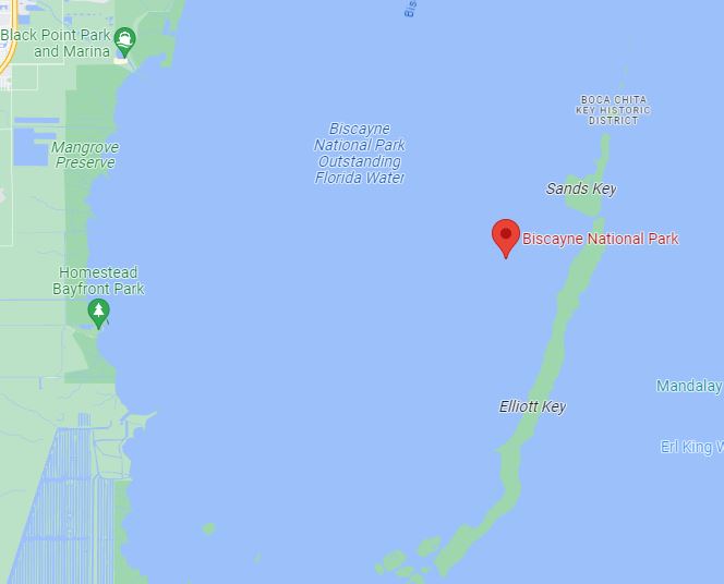
| Coordinates | 25°28′10″N 80°11′10″W |
| Area | 172,971 acres (699.99 km2) |
| Established | June 28, 1980 |
| Visitors | 469,253 (in 2018) |
| Governing body | National Park Service |
| Website | Biscayne National Park |
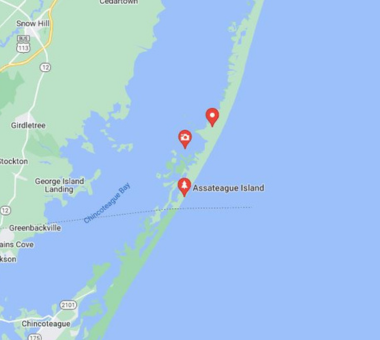
8) MARYLAND STATE PARK CAMPING, ASSATEAGUE ISLAND
Assateague Island offers everything from camping on the beach to swimming, surfing, crabbing, and, oh yeah, seeing a tons of wild horses just grazing around. Just remember that there is a national park and a state park on Assateague Island. Camp in the state park campsite if you want a hot shower, and lock up your food if you don’t want the horses to raid your tent.
Location and Map:
State park camping in Maryland With 37 miles of shoreline, there are plenty of beachfront campgrounds to choose from on this island.
| Coordinates | 37°58′35.07″N 75°18′17.12″W |
| Area | 63 km2 (24 sq mi) |
| Visitors | 469,253 (in 2018) |
| Website | Assateague Island National Seashore |
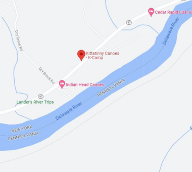
9) NEW YORK KITTATINNY CAMPGROUND, BARRYVILLE
The Kittatinny Campground provides a total of 350 isolated campsites that are situated within the scenic Catskill Mountains. One option is to establish a campsite within the dense forest, while another possibility is to don a tricorn hat and erect a tent beside the Delaware River, which is reputedly the same river that George Washington crossed during his journey to engage in warfare.
If one chooses the latter, they can personally traverse the river in order to access the zip lines and engage in paintball activities at Kittening’s Adventure Centre, located at Assateague Island, specifically at number eight.
Location and Map:
Barryville is a hamlet (and census-designated place) in Highland, Sullivan County, New York, United States.
| Open | Monday – Friday |
| Area Code | 845 |
| Website | Town of HighLand |
10) CALIFORNIA KIRBY COVE CAMPGROUND, MARIN HEADLANDS
The Marin Headlands is a prominent geographic feature located in Marin County, California. This campground offers four private campsites. It is known for its scenic waterfront vistas, which offer sweeping views of the cityscape, complete with the presence of Monterey cypress trees that provide shade.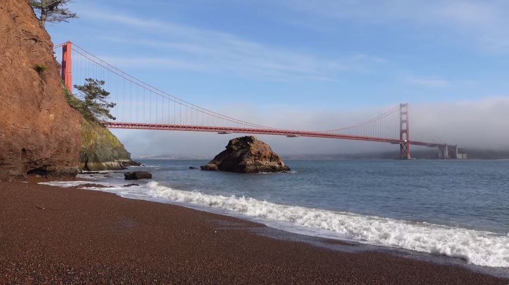 The premises are conveniently located in close proximity to a pebbly shoreline, allowing for easy access on foot. California is a state located on the western coast of the United States. Kirby Cove campground is located around 10 miles northwest of the Golden Gate Bridge
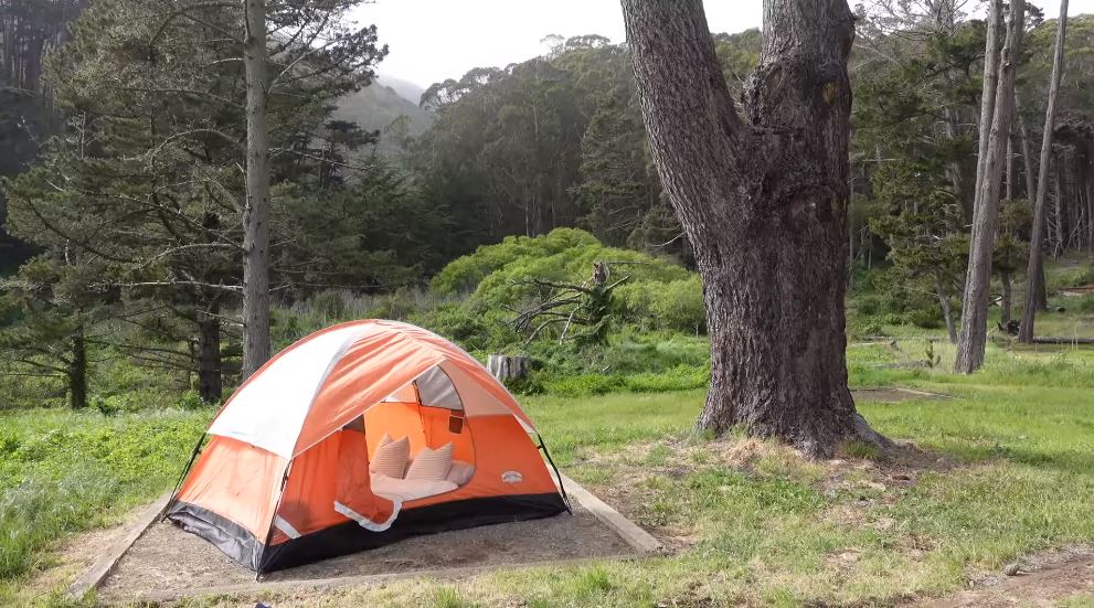 Additionally, there is a designated space suitable for daytime picnics. It is advisable to be observant of the presence of a rope swing, often suspended at the beach, should one like to get very remarkable photographs.
Location and Map:
Barryville, New York, is located in the Kittatinny region.

| Coordinates | 37.827039°N 122.490638°W |
| Area | 74.98 sq mi (194.2 km2) |
| Campus size | 400-acre (1.6 km2) |
| Facilities | Picnic Table, Waterless toilet |
| Website | recreation.gov |
Final Takeaways
The top 10 best camping places in the USA offer a thrilling tapestry of outdoor experiences, from beachfront serenity to mountainous retreats. Did you like what you saw let us know in the comments. Encounter wildlife, embrace natural beauty, and create unforgettable memories.